 Hiking
 Login
Login More
More EN
EN Premium
NodeMapp is expanding to Germany! Now explore the enchanting Black Forest through our virtual hiking node system. 6,000 km of hiking trails await you in our app and online route planner.
Since April 2023, we have broadened our horizon to Belgium’s neighboring countries with NodeMapp. We are proud to announce that you can now also plan routes in the Black Forest in Germany with our trusted (virtual) hiking node system. This popular holiday destination can now also be discovered with our online route planner and app. More than 6,000 km of beautiful hiking trails await you in this fairy-tale area.
Hiking in the magical Black Forest
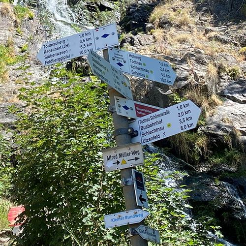
The Black Forest has been one of Germany’s most popular holiday destinations for years. It is a real paradise for hikers. From the dark, dense forests to the idyllic lakes, expansive vineyards and charming villages, there is something for everyone here. And now you can explore this unique area in an even better way with our virtual hiking nodes. This new virtual hiking network draws its information from OpenStreetMap. This is a global map that is created with the help of a comprehensive community. OpenStreetMap contains virtually all the beautiful hiking routes in the Black Forest. Most of these routes are local hiking loops. These are marked with the characteristic white signs with color markings:
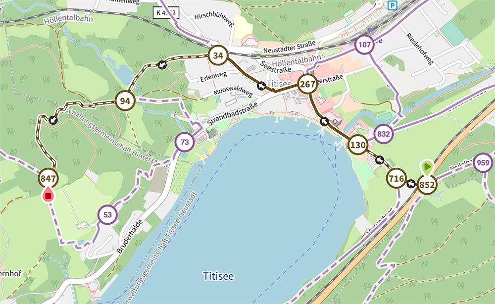
We have connected these hiking loops with each other and placed virtual hiking nodes with numbers at the intersections. This allows you to plan routes in the familiar way via our online route planner and app. You just select the nodes on the map and we connect them so that you get presented with the most attractive hiking routes. The virtual nodes are purple in color, which makes them easy to distinguish from the signposted nodes, which are red.
We offer a total of 6,000 km of virtual hiking networks in the Black Forest:
- Discover the enchanting Northern Black Forest: Allow yourself to be seduced by the charms of picturesque places like the elegant Baden-Baden, the serene Mummelsee, or the historic Freudenstadt.
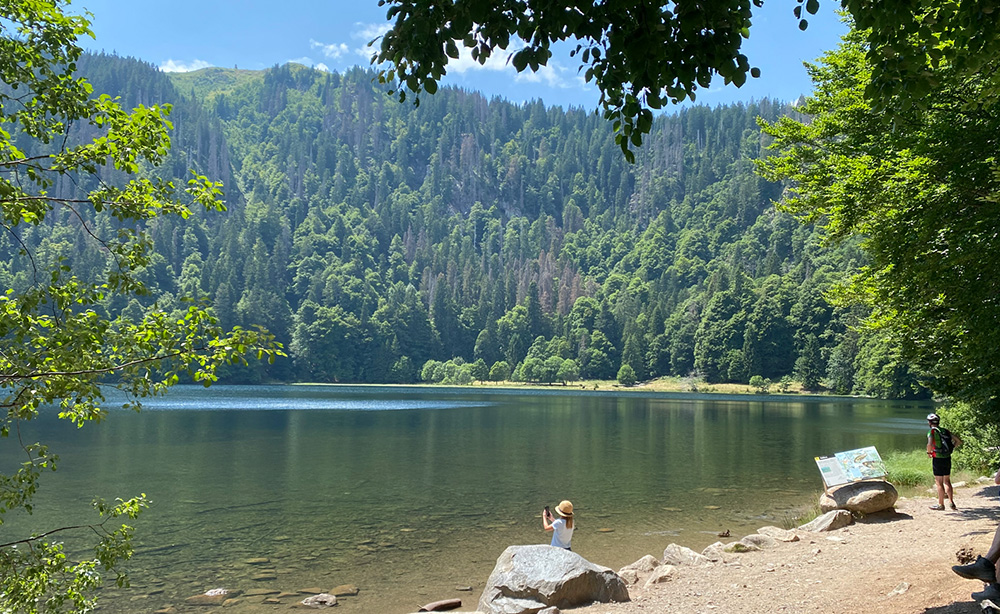
- Walk through the breathtaking Southern Black Forest: Admire the beauty of well-known locations such as the vibrant city of Freiburg, the idyllic Titisee, the impressive Triberg, or explore the highest mountain in the Black Forest, the Feldberg.
Let our app guide you
Once you’ve determined your route, all you need to do is enjoy. The handy navigation mode in our app guides you smoothly along your route. With the ‘Turn-by-turn’ navigation option, the app provides detailed instructions without you having to constantly look at your screen. Your task is simply to enjoy the breathtaking landscape while we take care of the rest.
Collaboration with RouteYou
NodeMapp entered into a collaboration with RouteYou a few months ago. This is another Belgian company active in the field of recreational navigation for hikers and cyclists among others. Both companies have worked behind the scenes, each separately, for years on maintaining data about hiking and cycling nodes. To manage the process around data management more efficiently, both companies decided to collaborate. As a result of this collaboration, RouteYou has become an important partner and data provider for NodeMapp. The rollout of a virtual hiking network in the Black Forest is a fruit of this collaboration.

 Upgrade to Premium Plus